Waegwan
Waegwan is the seat of government for Chilgok County, North Gyeongsang province, South Korea. It consists primarily of the administrative district of Waegwan-eup. It is situated on both sides of the Nakdong River, which is traversed by railroad, automobile and pedestrian bridges.
Waegwan is home to a Benedictine monastery and the United States Army base at Camp Carroll. It lies on the Gyeongbu Line of the Korean National Railroad, and is also connected to Daegu and other major cities via the Gyeongbu Expressway.
Waegwan's name literally means "Japanese dwelling," and may indicate that the town was a common stopping-point for Japanese salt traders during the Joseon Dynasty.
In the summer of 1939, Korean and Japanese students from the Daegu Normal School (now the teachers' college of Kyungpook National University) were sent to Waegwan to do forced labor on the Gyeongbu Line railroad tracks. A demonstration, known as the Waegwan Incident (왜관사건) took place on July 26, in which Korean students protested preferential treatment given to Japanese students. In consequence, seven of the students were expelled.
Map - Waegwan
Map
Country - South_Korea
 |
 |
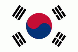
| Flag of South Korea | |
The Korean Peninsula was inhabited as early as the Lower Paleolithic period. Its first kingdom was noted in Chinese records in the early 7th century BCE. Following the unification of the Three Kingdoms of Korea into Silla and Balhae in the late 7th century, Korea was ruled by the Goryeo dynasty (918–1392) and the Joseon dynasty (1392–1897). The succeeding Korean Empire (1897–1910) was annexed in 1910 into the Empire of Japan. Japanese rule ended following Japan's surrender in World War II, after which Korea was divided into two zones; a northern zone occupied by the Soviet Union and a southern zone occupied by the United States. After negotiations on reunification failed, the southern zone became the Republic of Korea in August 1948 while the northern zone became the communist Democratic People's Republic of Korea the following month.
Currency / Language
| ISO | Currency | Symbol | Significant figures |
|---|---|---|---|
| KRW | South Korean won | â‚© | 0 |
| ISO | Language |
|---|---|
| EN | English language |
| KO | Korean language |


